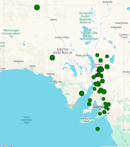
South Australia
earthquakes in South Australia seem to mostly follow a north-south trending axis, which extends from the Kangaroo Is. and Fleurieu Peninsula region in the south, though the Mt. Lofty and Flinders ranges, and then trends to the north east towards the Northern Territory. However, seismic events are also common in the St. Vincent's and Spencer's Gulfs, and on the Eyre Peninsula. Events located by the S.A.A. in 2023 are shown in the figure above.
The largest South Australian earthquake to date is the 1895 Beachport event (magnitude 6.5). However, the most damaging was the the 1954 Adelaide event (magnitude 5.4). Another region that saw high levels of seismicity in the late 1930's was the Simpson Desert region in the far north-east of the state, and extending into the Northern Territory. six events of magnitude 5.0 and above were recorded in the region between 1937 and 1941, with the largest, magnitude 6.4, occurring in June 1941.