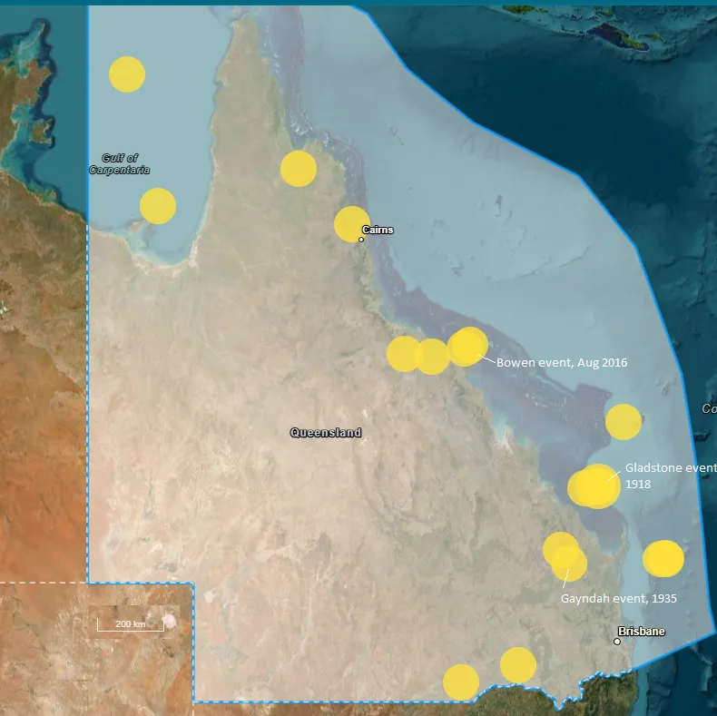
Queensland’s largest earthquakes have been along its eastern coast line. The largest was the magnitude 6.0 event off Gladstone in June, 1918, and a magnitude 5.8 event occurred offshore from Bowen in 2018. The Bowen event has had a long series of aftershocks, and small events related to the 2018 event are still occurring in 2024.
One of Queensland's notable damaging events was the magnitude 5.5 Gayndah event in April, 1935. This event was about 300 km NW of Brisbane.
Other than the events along the eastern seaboard, some events are noted in the Darling Downs region and to the west of it. Occasional events are noted in the southwest corner of the state.
Northern Territory
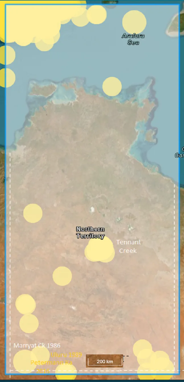
From 1900 onwards, the first recorded period of notable seismicity, was that in the Simpson Desert, near the South Australian border, and as noted in that section. The elevated seismicity in this region was mainly between 1937 and 1941, and included six events of magnitude 5.0 and above, with the largest being magnitude 6.4 in June, 1941 (on the NT side of the border).
However, probably the most significant series of events in Australia in recent times, commenced near Tennant Creek, in January, 1987, with four magnitude 5 events ( largest, magnitude 5.6) and large numbers of smaller events. The activity declined quickly over January, though aftershocks continued until June, 1987. Then, in early January 1988, almost exactly 12 months after the 1987 activity started, three more very large events occurred ( magnitudes 6.2, 6.3 and 6.8, all on 22nd January 1988. The damage resulting from these events was extensive, with the main SA- NT gas pipeline being severed. These events also caused an extensive ground ruptures/uplift, extending for about 30 km. Field recorders deployed during the sequence recorded thousands of tremors (mostly of magnitude 2 or less).
A large event occurred about 400 km southwest of Alice Springs in May, 1989 ( the Uluru event, magnitude 5.9). This event appears to have been solitary.
two magnitude 5 events (5.0, 5.4) occurred on 11 Feb 2004 near Mt. Redvers ( near the WA border).
a magnitude 6.1 event occurred in May 2016 in the Petermann Ra, near the border with SA and Western Australia. A scarp, about 20 km long, was discovered after this event. It has been determined that the fault that caused this scarp had a NW - SW orientation, and a dip of about 35 degrees.
The city of Darwin feels tremors on a relatively regular basis. However, the vast majority of these tremors have originated to the north and northwest of Darwin, where there is relatively high seismicity associated with the boundary between the Australian and Indonesian tectonic plated..

